Hi,
we are developing an application using DotSpatial.
We have a lot of problems with the print result of the layout.
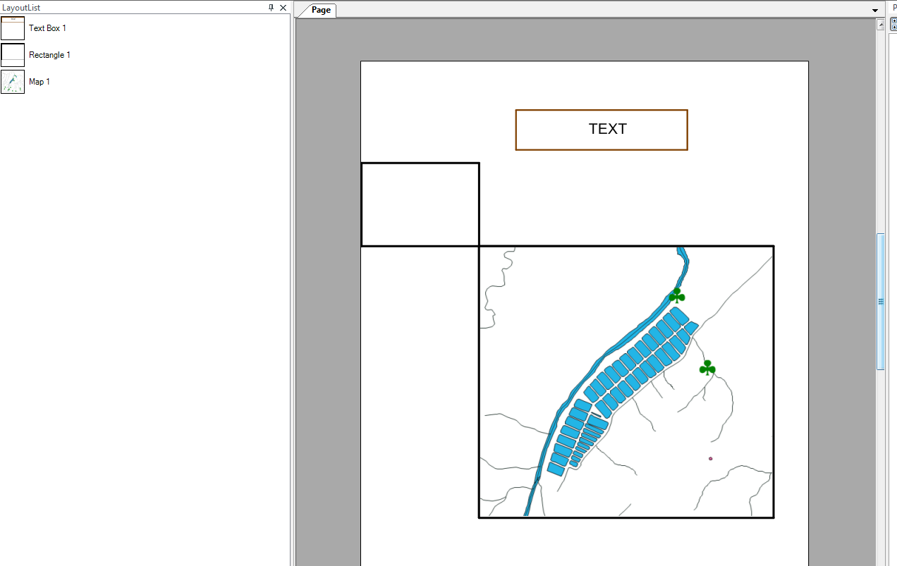
The following image shows my layout configuration; my layout is composed of a map, a rectangle and a text:
![Image]()
The following image shows now the result of the printing (to simulate a print, I have print a pdf file using PDF Creator. I have the same result if I print directly to a printer):
http://imgshare.free.fr/uploads/30c4c6237b.png
As you can see, there are a lot of differences:
Someone has already seen these issues? how can we have a print result conform with what we seen in the layout?
we are developing an application using DotSpatial.
We have a lot of problems with the print result of the layout.
The following image shows my layout configuration; my layout is composed of a map, a rectangle and a text:
The following image shows now the result of the printing (to simulate a print, I have print a pdf file using PDF Creator. I have the same result if I print directly to a printer):
http://imgshare.free.fr/uploads/30c4c6237b.png
As you can see, there are a lot of differences:
- the polygon layer are displayed with a shift
- some of line features are not displayed
- the point features symbol using a character symbol (Symbol font) are displayed with a bad resolution
-
The width of the rectangle, map and text border are not preserved.
Someone has already seen these issues? how can we have a print result conform with what we seen in the layout?